| Local time | 2024-02-08 15:30:18 |
|---|---|
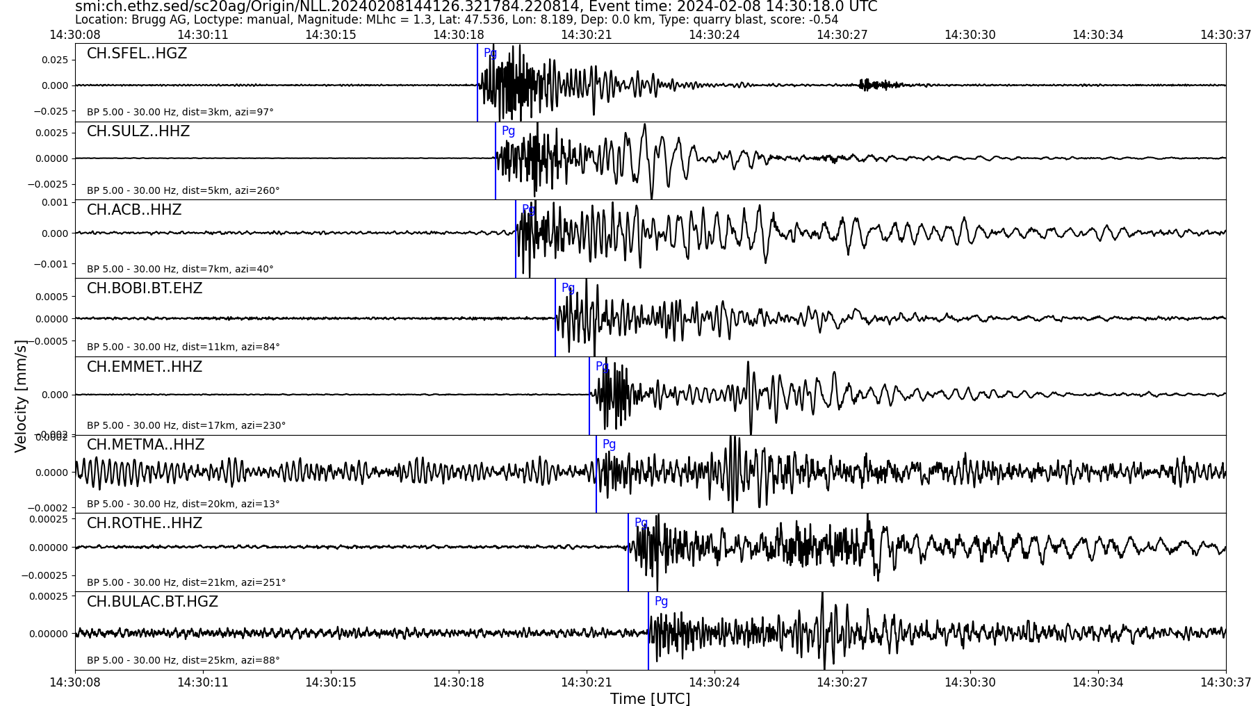
| UTC Time | 2024-02-08 14:30:18 |
| Event Type | quarry blast |
| Latitude / Longitude | 47.54 / 8.19 |
| Swiss Coordinates | 656513 / 265356 |
| Magnitude | 1.3 |
| Magnitude Type | MLhc |
| Location | Brugg AG |
| Depth [km] | - |
| Location Type | manual |
| Agency | SED |
| Last Update | 08-02-2024 14:41:32 |
| Danger level | 1 (as defined by federal agencies with responsibility for natural hazards) |
| Origin ID & Metadata | smi:ch.ethz.sed/sc20ag/Origin/NLL.20240208144126.321784.220814 |
|
GSE 2.1 provisional format |
|---|
| BEGIN GSE2.1 MSG_TYPE DATA MSG_ID 2024/02/08_023516660 CHE_NDC DATA_TYPE BULLETIN GSE2.1:short Reviewed Event Bulletin (REB) of the CHE_NDC for February 08, 2024, 02:30:17.974 EVENT 2024/02/08_023017974 LAUFENBURG Date Time Err RMS Latitude Longitude Smaj Smin Az Depth Err Ndef Nsta Gap mdist Mdist Qual Author OrigID 2024/02/08 14:30:17.97 0.04 47.5495 8.1635 2477.1 745.8 145 2.3 1.3 9 9 126 0.04 0.38 a i uk SED -------- Magnitude Err Nsta Author OrigID MLhc 1.7 0.2 7 SED -------- Sta Dist EvAz Phase Time TRes Azim AzRes Slow SRes Def SNR Amp Per Qual Magnitude ArrID SULZ 0.04 237.9 P 14:30:19.120 0.0 ___ 2461.9 a__ MLhc 1.7 -------- SFEL 0.05 110.4 P 14:30:18.771 -0.5 ___ a__ -------- ACB 0.07 58.3 P 14:30:19.720 0.0 ___ 1216.5 a__ MLhc 1.5 -------- BOBI 0.12 91.6 P 14:30:20.735 0.1 ___ 581.1 a__ MLhc 2.1 -------- ROTHE 0.18 246.0 P 14:30:22.415 0.5 ___ a__ -------- BULAC 0.24 91.7 P 14:30:23.000 -0.1 ___ 246.2 a__ MLhc 1.7 -------- SLE 0.31 46.0 P 14:30:24.289 0.0 ___ 110.0 a__ MLhc 1.4 -------- BERGE 0.32 2.3 P 14:30:24.735 0.1 ___ 131.5 a__ MLhc 1.8 -------- BALST 0.38 236.3 P 14:30:25.970 0.0 ___ 125.5 a__ MLhc 1.7 -------- STOP |